search
Czechia map
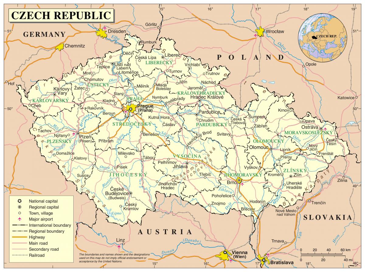
Map of Czechia. Czechia map (Eastern Europe - Europe) to print. Czechia map (Eastern Europe - Europe) to download. In Czechia, 606 cities and towns are registered in 2018, of which 27 are statutory cities. There is much more to Czechia besides the capital city of Prague. The Czech Republic is a small country, which makes for quick and easy traveling as its shown in Czechia map. The country boasts large cities with grand monuments such as Prague, Plzeň and Brno, small towns that are simply charming and fairy tale-like including Telč and Český Krumlov, the famous spa towns of Karlovy Vary and Mariánské Lázně, and tiny historic villages where it seems time has stood still, for example, Holašovice. And lets not forget the lovely wine towns of Znojmo and Mikulov – the wine country in Moravian is simply stunning. It is quite simply a joy to travel around Czechia, whether by train, bus or car, the sightseeing possibilities are endless.
In Czechia there are currently 5 international airports, in majority of cases flying to Prague airport is the best option, but in some case the smaller airport might be an alternative option. If you are travelling to the southern part of Czechia you should also check flights to Vienna as an alternative options. Obviously the Prague Václav Havel Airport is the busiest airport in Czechia as its mentioned in Czechia map.
Czechia routes 1-12 are the main arterial roads from Praha. Other main roads have numbers 13-99. So far, the only motorways are the D1, D2, D3, D5, D8, D11 and D35 as you can see in Czechia map. All these roads are European routes. Recently, motorway numbers have been starting to appear on signs. Before, only E numbers were signposted along motorways. On R roads, there was also a preference for E numbers, though the R numbea (without the letter 'R') were usually also indicated.


