search
Czech republic regions map
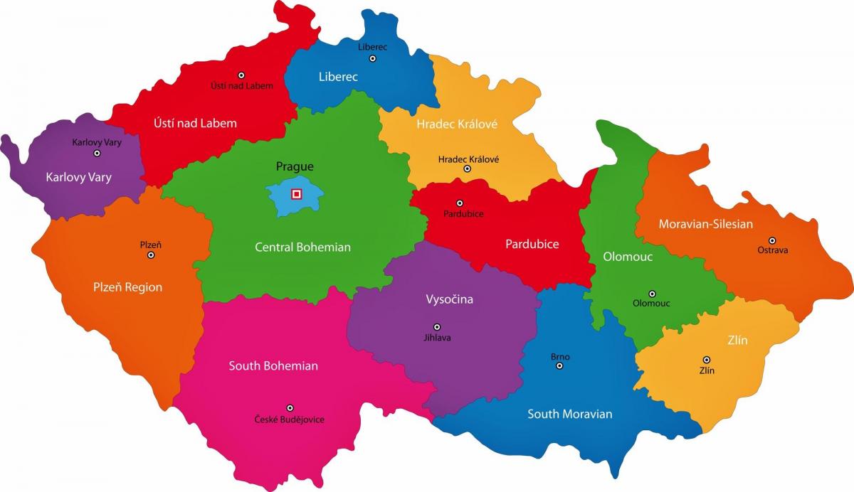
Czechia regions map. Czech republic regions map (Eastern Europe - Europe) to print. Czech republic regions map (Eastern Europe - Europe) to download. Czech Republic is divided into 13 regions (kraje, sing. kraj) and 1 capital city (hlavni mesto) as its shown in Czech republic regions map. The regions are: Central Bohemian, South Bohemian, Vysocina, Plzensky, Karlovy Vary, Usti nad Labem, Liberec, Hradec Kralove, Pardubice, Olomouc, Moravian-Silesian, South Moravian and Zlin. Praha (Prague) is the capital city. The regions are divided into districts and further smaller subdivisions of municipalities.
Since 2000, the Czech Republic is divided into thirteen regions (Czech: kraje, singular kraj) and the capital city of Prague. Each region has its own elected Regional Assembly (krajské zastupitelstvo) and hejtman (usually translated as hetman or "president") as its mentioned in Czech republic regions map. In Prague, their powers are executed by the city council and the mayor. The older seventy-six districts (okresy, singular okres) including three "statutory cities" (without Prague, which had special status) lost most of their importance in 1999 in an administrative reform; they remain as territorial divisions and seats of various branches of state administration.


