search
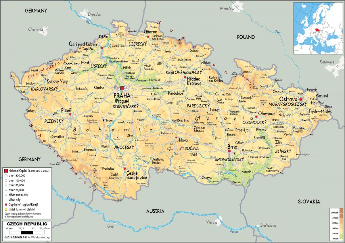
Czech republic physical map
Physical map of Czech republic. Czech republic physical map (Eastern Europe - Europe) to print. Czech republic physical map (Eastern Europe - Europe) to download. The Czech physical landscape is quite varied. Bohemia, to the west, consists of a river basin, drained by the Elbe (Czech: Labe) and Vltava rivers. It is surrounded by mostly low mountains such as the Sudetes with its part Krkonoše, containing the highest point in the country, the Sněžka at 1,602 metres (5,256 ft) as its shown in Czech republic physical map. Moravia, the eastern part, is also quite hilly and is drained predominantly by the Morava river, but also contains the source of the Oder (Czech: Odra) river. Water from the landlocked Czech Republic flows to three different seas: the North Sea, Baltic Sea and Black Sea.
The Czech Republic also possesses Moldauhafen, a 30,000-square-metre (7.4-acre) enclave in the middle of Hamburg docks as its mentioned in Czech republic physical map, which was awarded to Czechoslovakia by Article 363 of the Treaty of Versailles to allow the landlocked country a place where goods transported downriver could be transferred to seagoing ships; this territory reverts to Germany in 2028.


