search
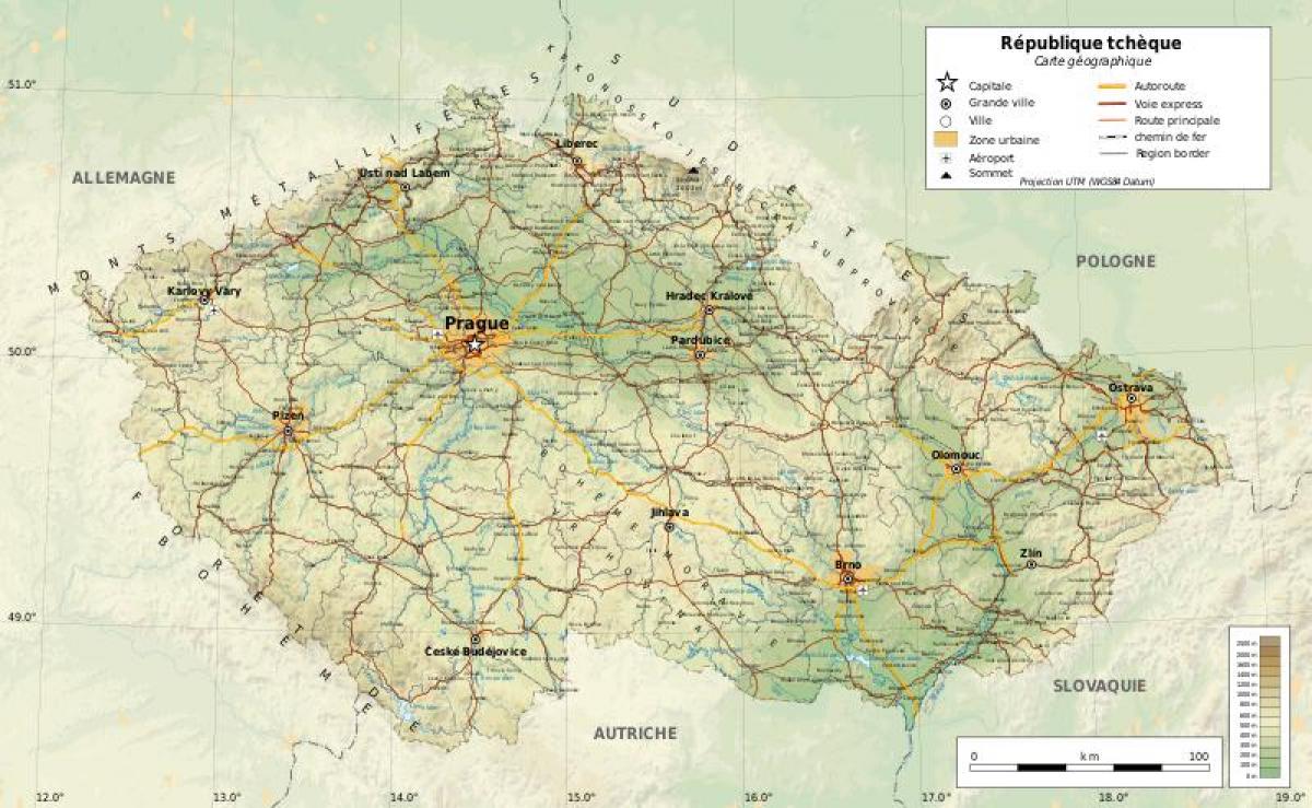
Czech republic geography map
Czechia geography map. Czech republic geography map (Eastern Europe - Europe) to print. Czech republic geography map (Eastern Europe - Europe) to download. The Czech Republic is a landlocked country situated in central Europe, sharing frontiers with Germany in the west, Poland in the north, the Slovak Republic in the east, and Austria in the south as its shown in Czech republic geography map. Covering only about one-third of the area of the United Kingdom, the country is hilly and picturesque. The western two-thirds of the country is known as Bohemia, and consists of a vast river basin fringed by hills and mountains. The Czech Republic longest river, the Labe, rises in the Krkonoše Mountains in the northeast, on the border with Poland, and flows south, then west, then north into Germany where it becomes the River Elbe. These mountains are also home to the country's highest summit, Sněžka which stand 1,602m (5,262ft) tall.
The eastern third of the Czech Republic is known as Moravia as its mentioned in Czech republic geography map. This region is also based on a river basin, that of the Morava River, which rises in the northern hills near the Polish border and flows south to join the Danube at Bratislava. The main city of Moravia is Brno, the second-largest in the Czech Republic. In the country there are 1351 reserve, including three large national parks with a total area 1111.2 km2. Reserves occupy almost 12% of the country. The Nature Conservancy has a long tradition in the Czech Republic, which is why many areas of the country are different ecological purity and are a popular destination for recreation and tourism. 15000 lakes and ponds, rock formations of sandstone, 2000 mineral springs, hundreds of palaces and castles, meadows and fields - all Czech Republic.


